Category Archives: Places

Wicked Hive

Gold Canyon, Arizona

We went for a great hike the other day in Usery Mountain Regional Park.

1220141038Rich had done the hike earlier with Wally, so he was my guide on the Wind Cave Trail.

1220141307

It’s a short hike at almost four miles round trip, and it’s got a decent vertical climb of almost a thousand feet.

Wind-Cave-06

Rich and Wally hiked it on a Tuesday and there were very few people. Way different population count on a Saturday. I’m guessing we passed at least otwo hundred people.

The scenery is beautiful from both the bottom

1220141103a

and the top of the hike.

1220141136

There’s an amazing ‘something’ above the Wind Cave.

1220141214a

Turns out it’s an active beehive.

1220141214

Wicked! It looks like some alien’s brain from Star Trek.

The actual Wind Cave was okay but not as impressive to me as the beehive. I think most people hike to the cave, rest a bit in the shade, and then hike down. One hiker/runner passed us several times as he did the trail three times in succession. Impressive!

1220141216

There is a municipal shooting range under the PHOENIX sign where dozens of shooters serenaded hikers with volumes of rounds sounding like fireworks.

1220141146

As we came down the trail, we passed some of Santa’s elves…

1220141251

Guess they were taking a break from making toys.

The Fabric of Our Lives

Gold Canyon, Arizona

Rich and I went for a drive yesterday in the lovely rain to explore the area a bit south of Gold Canyon.

Wedownload (2) toured the cities of Florence and Casa Grande and drove through miles and miles of cotton fields.

I had no idea that there were so many cotton fields in Arizona, but there are. In fact, cotton is one of Arizona’s Five C’s which contribute mightily to the state’s economy. The “5 C’s” of Arizona are cattle, climate, cotton, copper and citrus.

A bit of Arizona cotton history from ArizonaExperience.org.

About 900 cotton farms produce an average total of 600,000 bales and supplied approximately $362 million in cash to the state economy in 2011. That’s enough cotton for at least one pair of jeans for every person in the United States.

cotton-fabric-of-our-lives

Arizona is the birth place for Pima Cotton, a long-fiber variety (known as long staple cotton) named for the Pima Indians who helped cultivate it. This crop was responsible for Arizona’s cotton boom during World War I. Extra-long fibers make it both extremely durable and luxuriously soft, thus excellent for industrial and trade goods. Once bred for its durability, today, its brand, “Supima,” is popular with designers and high-end linen manufacturers.

In 1917, Goodyear Tire and Rubber Company bought land to cultivate long staple cotton for airplane tires, leading to the eventual founding of Goodyear, Arizona.

7660cottonPickerr4c000087642x2

Also from the same site, some information on how insects that target cotton are managed:

Many insects love to eat cotton plants. Historically, farmers have battled these pests, and the devastation of their crop, by spraying insecticides. Cotton is one of the most heavily sprayed crops, but too much pesticide can pollute fields and water sources.

Crop management changed when some cotton seeds were genetically modified to include Bt, a natural insecticide. This cotton actually kills boll weevils trying to feed on it, so farmers spray less.

(Fun song sung by Tex Ritter about boll weevils.)

Arizona farmers have developed another weapon in their pest-control arsenal: a moth factory. This enterprise targets the pink bollworm, a moth that lays its eggs in cotton buds and produces tiny striped worms that eat their way through the crop.

bollworm

To fight this persistent pest, agricultural specialists are taking drastic action. They are making more of them.

A 69,000 square foot warehouse located in the vicinity of Sky Harbor Airport churns out 22 million adult pink bollworm moths per day. But there is something special about these moths. A few minutes in a radiation chamber has taken away their ability to reproduce.

Of course, the moths don’t know that. When they are released on area cotton farms, they mate with naturally born adults. However, no babies are produced by these moths. The next generation of moths remains at a manageable size, ensuring the next generation of cotton.

Talk about effective birth control! 🙂

cotton

Hieroglyphic Petroglyphs

Gold Canyon, Arizona

We decided yesterday morning to take a hike.

1215140921When Sophie heard us say the word “walk” early in the morning, she was suddenly wide awake. Well, awake enough to climb out from under the covers.

We decided to go on a hike called the Hieroglyphic Trail.

At a bit over three miles round trip, it’s a relatively short hike with a little less than 600 feet in total elevation gain. However, it’s very rocky in places and has a few challenging climbs.

There are actually three hikes at the trail head including the Lost Goldmine Trail. We’ll save that one for another day. (But I loved the signage enough to include it today.)

1215141154

1215140952

We walked through a gate to get into the Superstition Wilderness in Tonto National Park.

1215141143

No matter what angle they are shot from, the Superstitions are simply stunning.

1215140950

Last week’s rain was just enough to germinate new growth.

1215140951

Parts of the trail were very rocky and there was an amazing amount of shrubbery considering we’re in the desert.

1215141028

Near the top of the trail, we saw lots of people studying the hieroglyphs.

1215141034

On our hike we wondered… What is the difference between a hieroglyph and a petroglyph? We had no clue, so I turned to Google.

A hieroglyph is a picture or symbol used in a system of writing.

A petroglyph is a pictogram (a pictorial symbol for a word or phrase) created by removing part of a rock surface by incising, picking, carving, and abrading.

So the hieroglyph is the symbol that becomes a petroglyph when it is inscribed in rock. At least that’s what I deciphered from everything I read on a Google search…

Here are some pictures of the hieroglyphic petroglyphs at the top of the trail.

1215141110 1215141108 1215141107a 1215141107

We also saw an amazing balancing rock at the top of the canyon walls.

1215141036It was a great hike!

Ode to Snow

Gold Canyon, Arizona

I’m really missing snow especially with the recent huge storm along the California coast that’s dumping lots of snow in the Sierras.

Rich and I took a drive to Lake Tahoe many years ago after such a storm so I could take pictures.

These look like they’ve been Photoshopped, but they weren’t. The sun was shining through parts of the clouds and made Tahoe look like it was iced over.

It was a very special day, and I’ll let the pictures speak for themselves…

OLYMPUS DIGITAL CAMERA

OLYMPUS DIGITAL CAMERA

OLYMPUS DIGITAL CAMERA

OLYMPUS DIGITAL CAMERA

OLYMPUS DIGITAL CAMERA

OLYMPUS DIGITAL CAMERA

Apache Trail Circle Route

Gold Canyon, Arizona

Wow, what a great road trip we took yesterday.
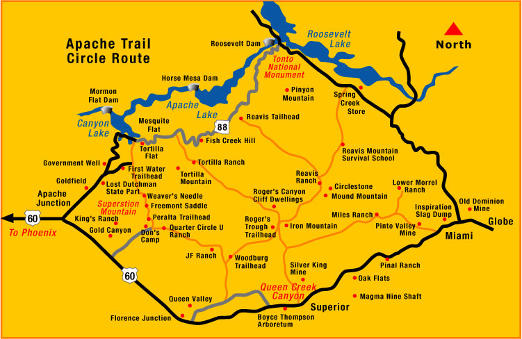
apache-trail-circle-map-lg

Apache Trail Circle Route is a 120 mile historic road that runs east from Apache Junction to Theodore Roosevelt Lake. From there it runs south to the junction between Globe and Miami. Then west to Superior and on through Queen Valley and back to Apache Junction through Gold Canyon.

Although the trail’s official name today is “State Route 88”, it adopted the name “Apache Trail” in reference to the Apache Indians who originally inhabited the Superstition Mountains. The road was initially built as a way to open copper trade between the city of Globe and the Phoenix area. Today, however, it has become a very popular tourist destination. Winding through the Superstition Mountains, this circular road provides some of the most beautiful scenic views in central Arizona. It guides you up and down the steep desert mountains, past cliff dwellings, lake shores, eroded canyons, and old mining towns. (From viator.com)

Here are some pictures and highlights of our trip…

Canyon Lake is simply stunning. It is one of four reservoirs formed by the damming of the Salt River. The lake was formed by the Mormon Flat Dam, which was completed in 1925.
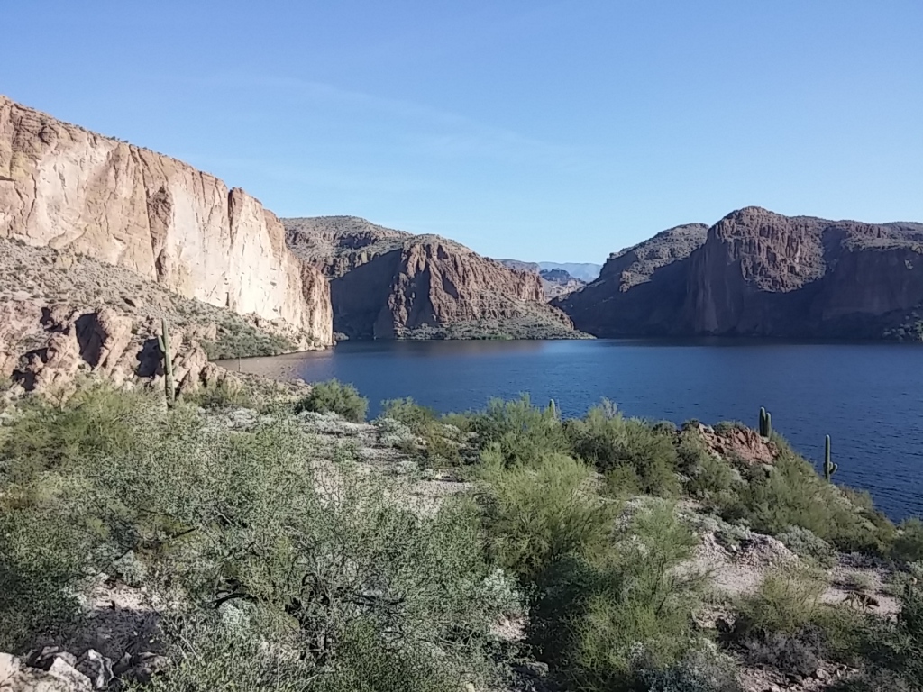
1210141002

There were lots of fishermen in the lake, and  many birds reside in the area. It’s a birders’ paradise. We saw coots, mergansers (no clue what type),  and a type of hawk that I’m still trying to figure out. (He was huge with a buff colored chest.)
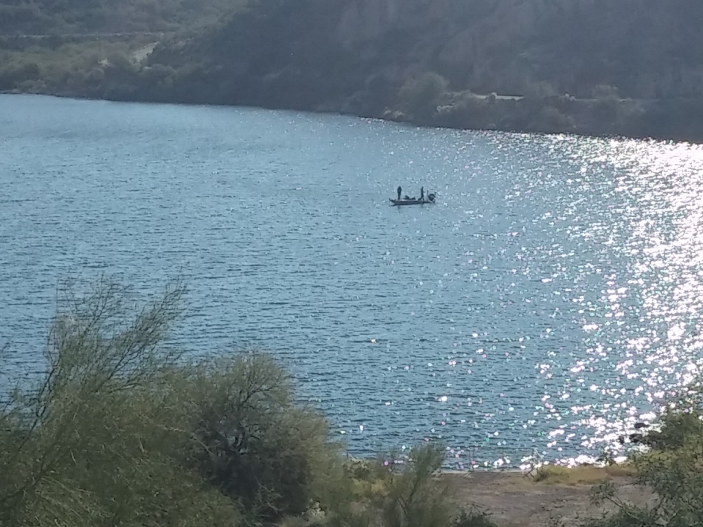
1210141001a

Just a bit east of Canyon Lake we saw hunters with HUGE telescopic lens looking for bighorn sheep. They obviously were set up for a long day because they had shade umbrellas and walkie talkies…
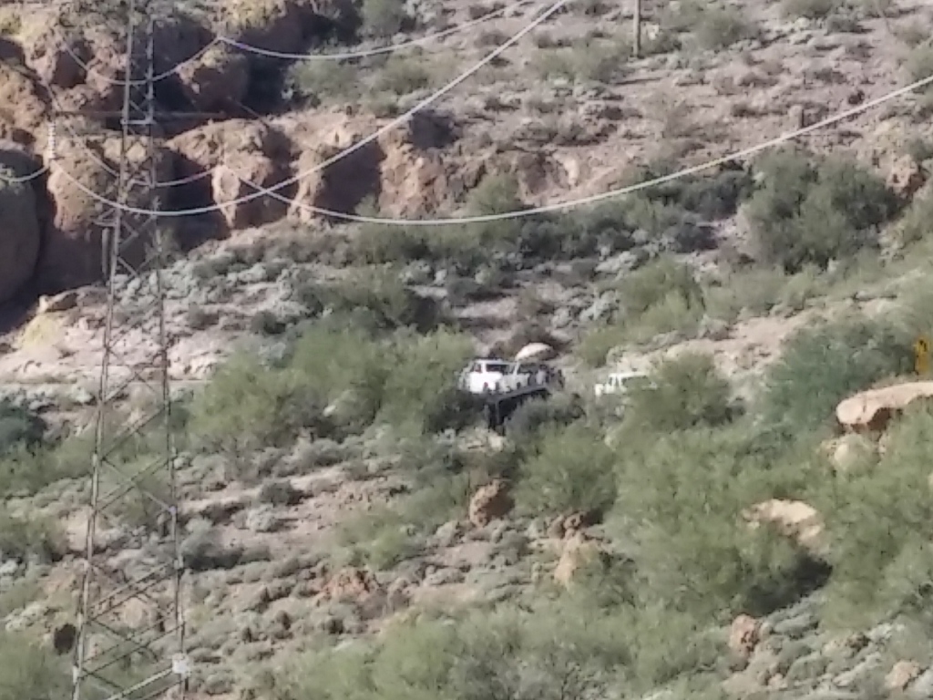
1210141015

…to talk with their fellow hunters across the valley actually hunting the sheep.  We didn’t see any sheep, but we did see the hunters with our binoculars smack dab in the middle of this picture. Can you see them? Ha ha… I couldn’t either, but Rich did and pointed them out so that I finally saw them.
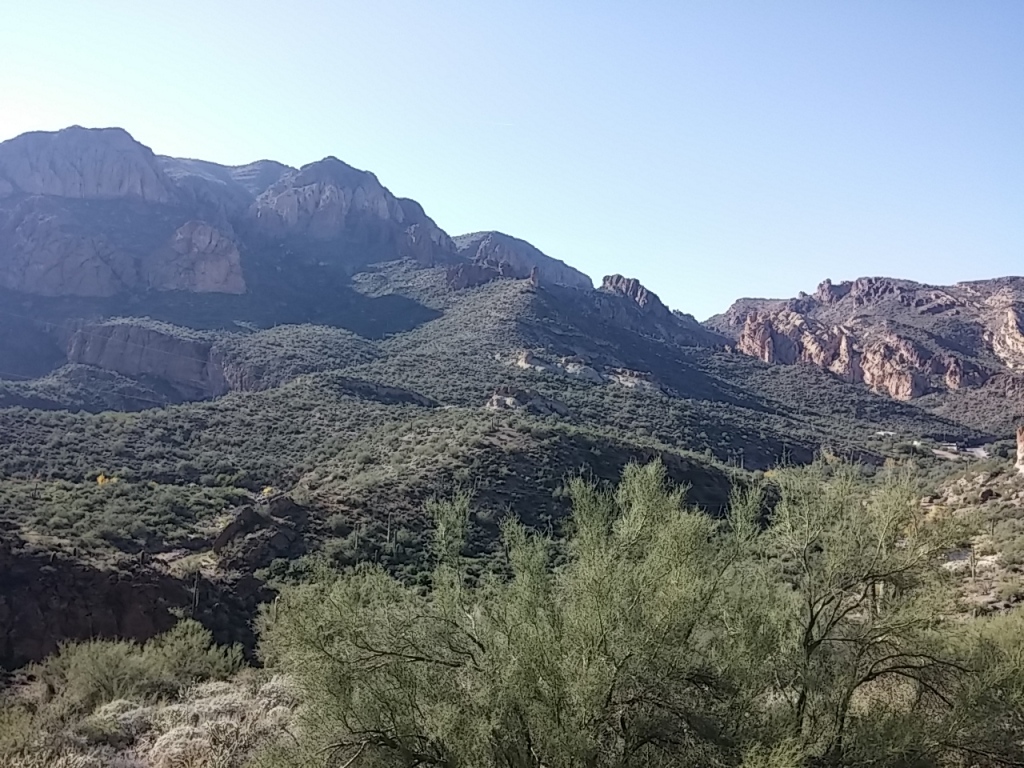
1210141015a

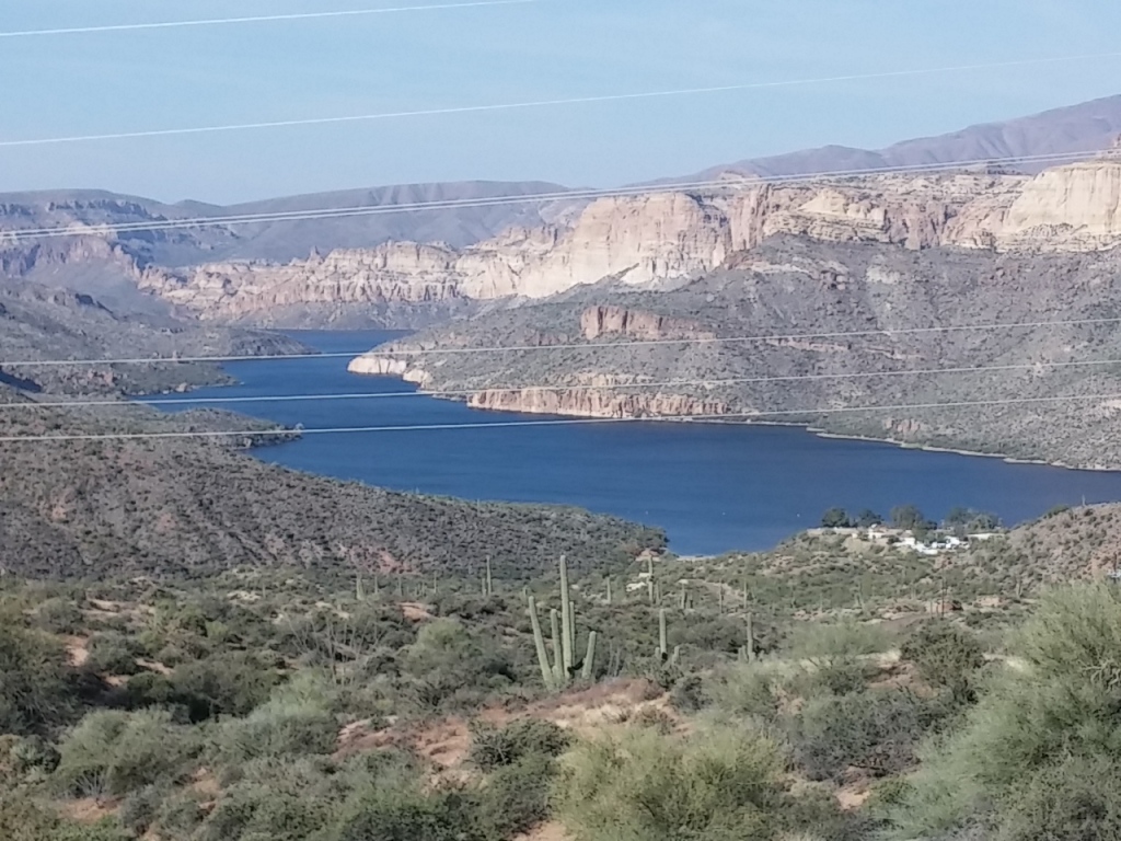
This is the first part of Apache Lake we saw. It’s a long skinny lake that must be very popular with house boaters based on the number of them we saw docked in the marinas.

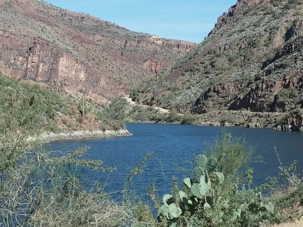
Apache Lake is formed by Horse Mesa Dam which impounds the Salt River. It was completed in 1927 and is the second largest of the four Salt River Project reservoirs.
1210141110

Our drive took us right alongside the length of Apache Lake.
1210141215

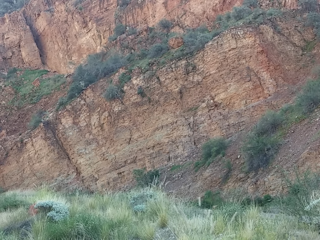
All the vegetation on the north side of the mountains is sublimely green and lush.
1210141234

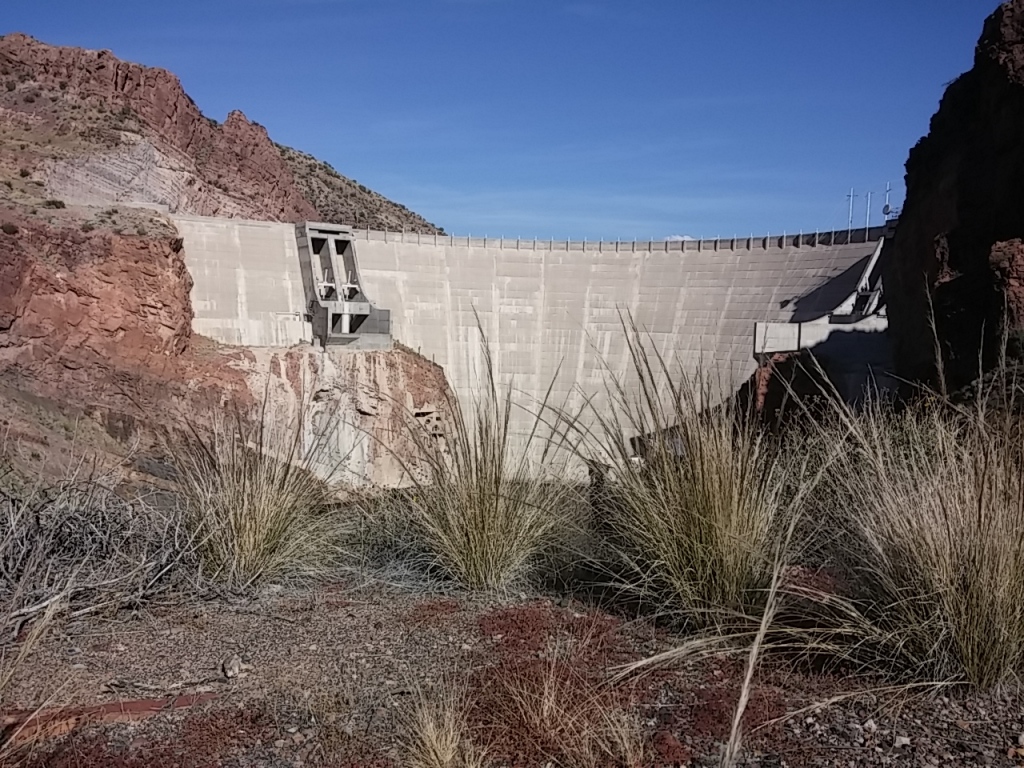
At the end of Apache Lake is the Theodore Roosevelt Dam which is at the base of Theodore Roosevelt Lake. This dam is the largest of the Salt River Project Dams, and the Roosevelt is the largest lake that is wholly inside the state of Arizona.

Construction of the Roosevelt Dam started in 1904. When it was completed in 1911, Roosevelt Dam was the tallest masonry dam in the world at 280 feet.
1210141231

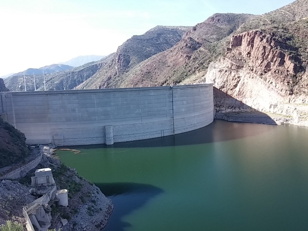
In 1996, a massive expansion project aimed at increasing the capacity of the lake was finished. The dam was resurfaced with concrete and raised an additional 77 feet.

This increased the lake’s capacity by over 20% and provided much needed flood control space on the Salt River. Shortly after completion, however, the area entered into a prolonged period of drought, and it wasn’t until 2005 when the new capacity was used. The lake reached 100% capacity in 2009.

You can see the demarcation line for the old and new portions of the dam in this photo of the back side of the dam.
1210141246a

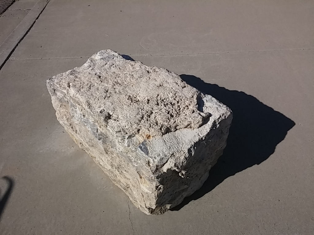
All of the block for the original portion of the dam was hand cut. Here’s a sample.
1210141302

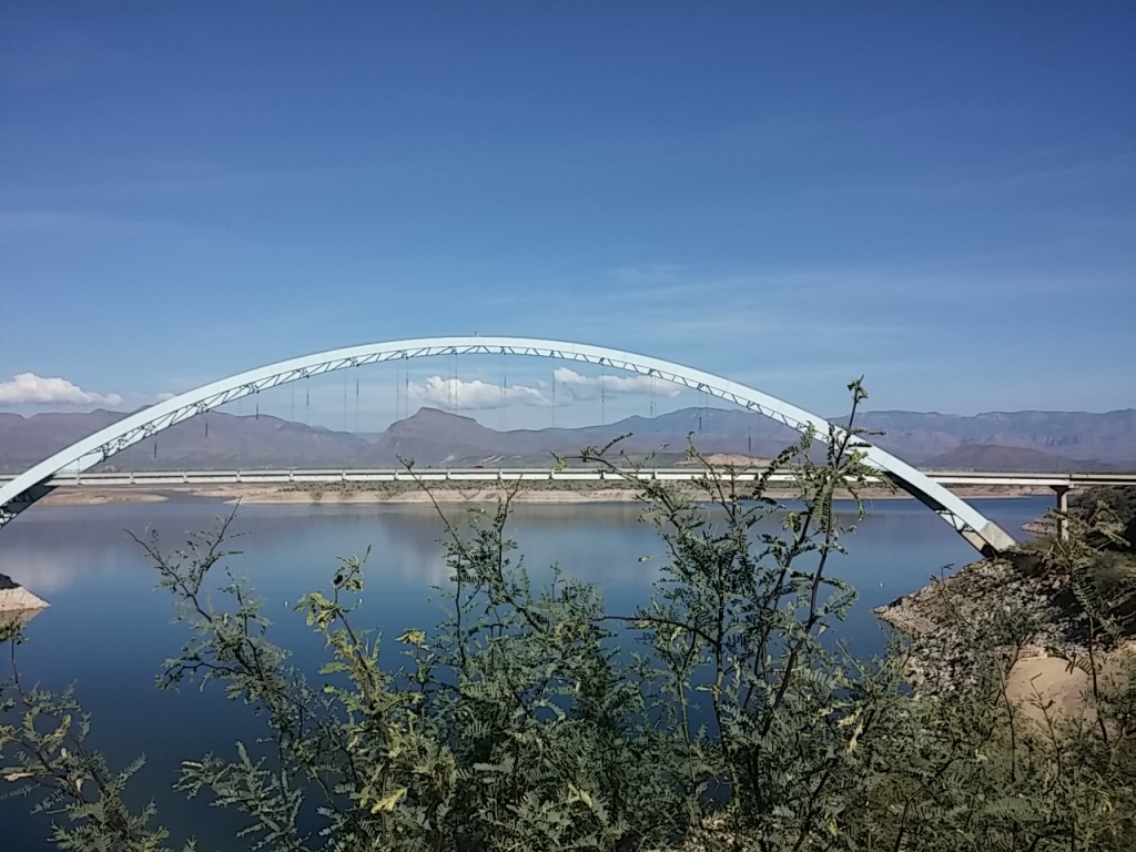
And spanning the lake just near the dam is the Roosevelt Lake Bridge. It is painted a beautiful light blue and is just stunning. In 1996 it was named one of the twelve most outstanding bridges in the nation; that list included the Golden Gate and Brooklyn bridges.
1210141300

Superstitions

Gold Canyon, Arizona

We went for a long hike yesterday morning. It was grand!

We saw some amazing flowers…

1208141002

But the focus for much of the hike was the Superstition Mountains. (All remaining images were harvested off the ‘Net.)

superstition-mountains

We are currently staying in the eastern portion of the Valley of the Sun which is bordered on the east by the Superstition Mountain Range. 

The Superstitions are always beautiful, but this morning we noticed a new green tinge to them, the result of last week’s heavenly rain.

2366071786_6e8a95dfb3

The range resides within Superstition Wilderness which was designated in 1939. It now contains approximately 160,200 acres. There is a well-developed trail system, and the western end of the wilderness receives heavy use during the cooler times of the year.

The area is starkly beautiful and often rugged, but it can be inhospitable to those not equipped to meet nature on her own terms. Searing heat and a shortage of water are typical conditions in the summer. Bitter cold, rains (and even snowstorms) may occur in the winter. (From US Forest Service)

Later this week we plan to take a scenic drive around the mountain range. I’ll be taking lots of pictures during the drive for a more robust post…

In the meantime a bit of Native American lore about the Superstition Mountains:

Some Apaches believe that a hole leading down into the lower world, or hell, is located in the Superstition Mountains. Winds blowing from the hole are supposed to be the cause of severe dust storms called haboobs in the metropolitan region.

haboob-phoenix-7-3-2014-richardPayne-abc15-e1404478520555

Silly Mountain

Gold Canyon, Arizona

We went on a great hike yesterday morning on and around Silly Mountain.

silly-mountain-arizona3

It’s a set of trails that are managed by the city of Apache Junction.

1201141134

There are a couple of different trails that are well marked by signs, at least on the front of the mountain. On the back, the signs are rather sparse.

1201141023

The elevation gain is only 412 feet, but it felt like more than that. Maybe that’s because we went up and down multiple times.

The trails are open to hikers, horseback riders, and mountain bikers. We didn’t see any bikers, but I did come across a fun review of the park on a mountain biker’s site:
My recommended route: Palo Verde >> Superstition View >> Old Baldy >> Crest. Then drop in at Old Mine for a gnarly descent or backtrack to Huff & Puff for a less technical but still steep descent. Steer clear of Jackrabbit and the east side of Superstition View. Lots of HAB.

I wondered what HAB was. It’s biker shorthand for Hike a Bike–means you have to carry your bike a lot. 🙂

There’s a great map at the start of the trails which we neglected to pickup. But we managed to get lost and off trail only one time…

silly-map-550

We climbed to the highest peak and were rewarded with great views.

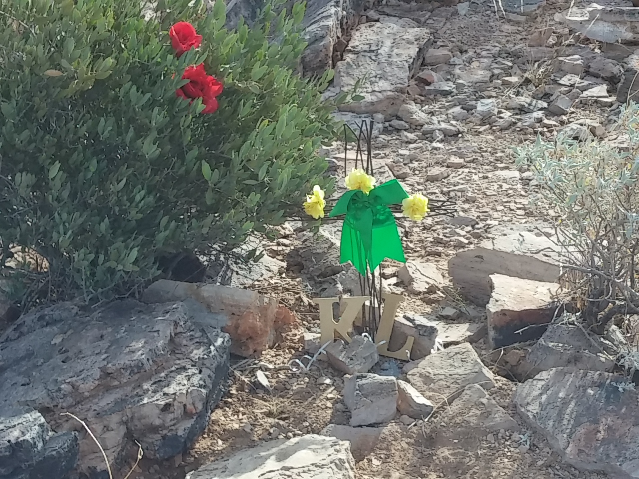
1201140954

Including a memorial complete with roses for KL.

1201140953

And a geological survey marker marked “SILLY MTN”.

1201140953a

Beautiful wildflowers…

1201141032

It was fun to go hiking in a new spot and see new things.

1201141000

It’s really hard to see in this picture, but we happened to look up at just the right time and see two different guys standing on the top of two different peaks with their arms raised in exhalation. Fun!

1201141058

And the best thing is that Sophie’s all tuckered out. Dirty but tired, and a tired dog is a good dog…

1201141328

On the Apache Trail

Gold Canyon, Arizona

We went for a drive along the Apache Trail yesterday. It runs along State Route 88 and bills itself as America’s Oldest Highway, celebrating 100 years.

The Apache Trail was a stagecoach trail that ran through the Superstition Mountains. It was named after the Apache Indians who originally used the trail to move through the Superstitions.

It’s been a while since we’ve been on a road trip other than to Costco and Winco. Sophie was hap-hap-happy!

1128141142

The drive was beautiful. The scenic road had lots of curves and one lane bridges. Lots of fall foliage and even a bit of shade.

1128141146a

We passed through the teeny, tiny town of Tortilla Flat. It’s a funky little western town.

1128141223

They serve a mean hamburger and provide live music.

1128141222a

One of the two stores in town has covered its walls and ceilings with thousands of one dollar bills…

1128141229

1128141229a

The original school house is now the museum.

1128141226a

There are lots of mining and old western antiques and replicas.1128141226

Something interesting  happened when we stopped to look at Canyon Lake.

1128141030

We saw three men riding Harley Davidson motorcycles. They had stopped and were taking pictures of one another. Unfortunately I didn’t get a very good picture of them.

But the interesting thing is that Rich and I came to the same conclusion about the three men but we got there by very  different analyses…

1128141031

We determined that two of them were newbie motorcyclists and one was a seasoned veteran.

Rich noticed that two of them parked with their front wheels by the curb while the other backed in so that his bike was ready for him to take off. He explained to me that motorcycles don’t have a reverse gear, so most bikers take the time to position their bikes so they can take off without having to reposition the bike.

I noticed that the two who parked the same way had brand new leather coats. They were very shiny compared to the other rider whose coat looked like it had been on hundreds of rides, through all sorts of weather.

While Rich and I often agree on things, we seldom see things the same way… 🙂

Arizona Fast Facts

Gold Canyon, Arizona

Since we’re going to be in the Phoenix area for another two months, I thought it was time for me to learn a bit more about Arizona.

State Flag: (The flag of Arizona consists of 13 rays of red and weld-yellow on the top half, the colors of the flag of Spain, representing the 13 original states. The red and yellow also symbolize Arizona’s picturesque sunsets. The copper star represents the copper mining industry in Arizona. The rest of the flag is colored blue, representing Colorado River.)

AZ

  State Nickname: Grand Canyon State (In addition to its geologic wonders, the Canyon contains outstanding biological diversity, containing five of the of the seven life zones which is the equivalent of traveling from Mexico to Canada. It is home to numerous rare, endemic (found only at Grand Canyon), and threatened/endangered plant and animal species. The park contains over 1,500 plant, 355 bird, 89 mammalian, 47 reptile, 9 amphibian, and 17 fish species.)

gc

State Flower: Saguaro Cactus Blossom (Saguaros are the largest cactus species in the U.S.—they can grow more than 40 feet tall. A typical saguaro can live between 100-200 years.  A fully-grown saguaro can weigh more than a ton.  Depending on how much water they amass, saguaros can shrink or swell in girth by 20-25 percent over the course of a year.)

sb

State Gem: Turquoise (Turquoise is a blue to gray-green mineral consisting of copper aluminum phosphate. The mineral turquoise is formed by a chemical reaction which occurs when water containing specific minerals such as copper and aluminum leak through a rock. It forms in veins, which later then turn into a clump of turquoise.)

tq

State Bird: Cactus Wren (While the female is incubating on clutch of eggs, the male wren builds another nest. This nest will be used or a second clutch of eggs as the parents may rear several broods of young in one year. Building the nest in cactus provides some amount of protection for the young. The wrens also use these nest throughout the year as places to roost.)

cw

State Tree: Palo Verde (Palo Verde is a relatively small tree that can reach a height of approximately 32 feet and a trunk diameter of 1.5 – 2 feet. This tree has a deep root system which allows it to tap into the ground water and survive periods of extended drought and withstand severe flash floods. Palo Verde is drought deciduous (sheds its leaves during extended dry spells) at which time the tree relies on its green stems and branches for photosynthesis.)

palo_verde_6115

State Fish: Arizona Trout (aka Apache Trout) (The Apache Trout has a golden color with black spots. It can weigh up to 6 pounds, and grows to 24 inches long. The Apache Trout is unique to Arizona, and is not found anywhere else. It is considered an endangered species, but recent conservation efforts have allowed the state to permit some sport-fishing of the Apache Trout.)

at
State Neckwear: Bolo Tie (Silversmith Victor Cedarstaff of Wickenburg, Arizona, claims to have invented the bolo tie in the late 1940’s (and later patented his slide design) but it is also said that bola ties are a North American pioneer creation that dates back to between 1866 and 1886. Boleadoras orbolas (from Spanish bola, which means “ball”) are throwing weapons made of weights attached to the end of cords.)

bolo-tie

PS Who new states had official neckwear? I sure didn’t… 🙂


Mesa Marketplace

Gold Canyon, Arizona

We went to the Mesa Market yesterday. It is an amazing place.

Capture

“There is more to see here than anyone can see in one day! A single breezeway covers a mile and a quarter of shopping lanes. 900 merchants stock 1600 shops. The place is enormous. The pace is relaxed, the merchants are friendly, and there are lots of places to sit and people-watch, too.” (mesamarket.com)

While we were there, we ran into Fred and Hope. Fred’s a pickleball buddy from Boise, and they just bought a park model at our resort. They were looking for yard art for their new place. They won’t be disappointed by the choices available at the market.

1121141006a

We passed by one man trying to convince his wife to buy this metal burro.

1121141015b

He wanted to place it with its head towards their house and find a sign to place near the back end of the burro that said, “KISS MY…” 🙂

It’s always amazing what special deals are available at a market. These bras were a steal at 6 for $25. But you just gotta wonder how comfortable they were.

1121141013

There are so many items available: everything from apple parers to hot tubs to zebras made from metal.

And if you get too tired, you can always rent a scooter to get around.

Wheelchair

We found our favorite garlic rub (in the 80% less salt version). We first found it at the Garlic Festival about 20 years ago in Gilroy, California. If you love garlic, you’ll love Garli Garni. Yummy!

TSR_091202_9138

I also bought a HipKlip to carry my cell phone. (They are available in many different sizes and styles online at hipklips.com.)

double_zip_cat_photoOoh, and last time there I found these vegetable keepers made by Hutzler. I already had the onion keeper, so I bought the green pepper keeper. They are fabulous and available at amazon; check out the entire Hutzler food storage line at Hutzler.com.

346757996761586927_0755331b1c09

Can’t wait to go shopping again to see what other amazing things I can purchase and somehow stuff into Homer’s already bulging cabinets.